


Product Description
Physical & Performance
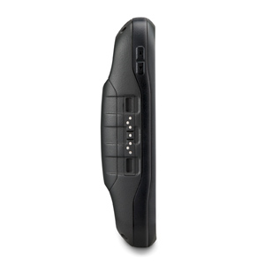
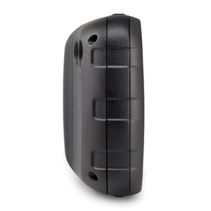
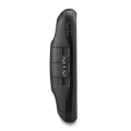
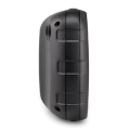
| Physical dimensions | 2.9″ x 5.9″ x 1.4″ (7.48 x 14.96 x 3.63 cm) |
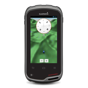
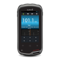
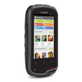
| Display size, WxH | 2″W x 3.5″H (5.06 x 8.93 cm); 4″ diag (10.2 cm) |
| Display resolution, WxH | 272 x 480 pixels |
| Display type | bright, transflective 65k color TFT, dual-orientation touchscreen; sunlight readable |
| Touchscreen | Yes |
| Weight | 11.7 oz (331 g) with included lithium-ion battery pack; 13.2 oz (375 g) with 3 AA batteries (not included) |
| Battery | rechargeable lithium-ion (included) or 3 AA batteries (not included); NiMH or Lithium recommended |
| Battery life | up to 16 hours (lithium-ion); up to 22 hours (AA batteries) |
| Water rating | IPX7 |
| High-sensitivity receiver | Yes |
| Interface | High-speed USB |
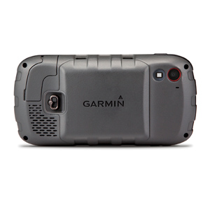
| Camera | yes (8 megapixel with autofocus and 1080p/30fps video; LED flash; automatic geo-tagging) |
| Barometric altimeter | Yes |
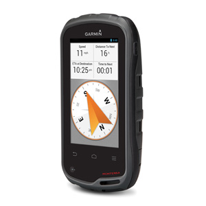
| Electronic compass | Yes (tilt-compensated 3-axis) |
| Unit-to-unit transfer (shares data wirelessly with similar units) | Yes |
Maps & Memory
| Basemap | Yes |
| Preloaded maps | yes (topographic), some models |
| Ability to add maps | Yes |
| Built-in memory | 6 GB (With Worldwide Basemap); 3 GB (With TOPO U.S. 100K Maps) |
| Accepts data cards | microSD™ card (not included) |
| Custom POIs (ability to add additional points of interest) | Yes |
| Waypoints/favorites/locations | 4000 |
| Routes | 200 Track log 10,000 points, 200 saved tracks |
Outdoor Features
| Automatic routing (turn by turn routing on roads) | Yes (with optional mapping for detailed roads) |
| Geocaching-friendly | Yes (Paperless) |
| Custom maps compatible | Yes |
| Area calculation | Yes |
| Picture viewer | Yes |
Garmin Connect®
| Garmin Connect™ compatible (online community where you analyze,categorize and share data) |
Yes |
Additional
| Additional Bluetooth® wireless technology: | yes |
| Wi-Fi connectivity: | yes |
| ANT+™ connectivity: | yes |
| GNSS support: | yes (GPS + GLONASS) |
| Near Field Communication (NFC): | yes |
| Microphone: | yes (internal for audio capture) |
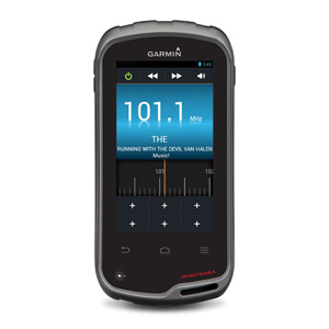
| Multimedia (audio/video) support: | yes (MP3 player, video player, etc.) |
| UV sensor: | yes |
Android with Google Play for complete customization
Reviews
There are no reviews yet.